
To clean addresses for mapping, you break free-text address strings into consistent components, standardize those components to one canonical form, drop records that can never resolve, and only then geocode them. Skip that order and your map fills with dropped pins, wrong blocks, and city centroids standing in for real locations.
The fastest reliable route is a four-stage pipeline: parse, normalize, validate, geocode. Most teams that skip straight to geocoding lose 10 to 30 percent of their records and never find out why.
Before you start, here is the fast path in one list:
- Freeze the raw source table. Never edit it in place.
- Work on a copy with one row per address, plus a stable id from the source.
- Split the string into components before changing anything.
- Expand abbreviations to one canonical form and apply the same rules to every row.
- Deduplicate on the normalized fields, not on the raw string.
- Geocode, then read the match type, not just the coordinates.
- Keep lat, lon, match type, match score, and a change log alongside every row.
One benchmark worth knowing before you plan your runtime: in a well-documented practitioner run over 18 million fire-incident records, an exact-match row resolved in about 61 milliseconds, while malformed rows that forced a multi-state search averaged about 342 milliseconds per row. Cleaning is a speed and cost decision as much as an accuracy one.
Table of Contents
- What You Need
- Step-by-Step
- Common Mistakes
- Frequently Asked Questions
- What is the best way to clean addresses for mapping?
- Should I standardize address abbreviations before geocoding?
- How do I remove duplicate addresses without deleting valid locations?
- What confidence score should I accept from a geocoding service?
- How should I handle apartment numbers and missing street addresses?
- Can I clean addresses in Excel or Google Sheets?
- Do international addresses need different cleaning rules?
- When should I clean addresses relative to mapping?
- Conclusion
What You Need
You need six things, and only one of them is software.
An untouched source table. Export or copy it and treat it as read-only. Every cleaning rule you apply should be re-runnable against the original, otherwise nobody can reproduce your map six months later.
A working copy with a stable id. Add a row id at this stage if the source has none. You will need it to link cleaned rows back to source rows and to record which source rows got merged.
A component schema. Decide your column names before you start: house_number, pre_direction, street_name, street_suffix, unit, city, region, postal_code, country. Different tools default to different names, and mismatched column names are the most common reason a cleaning script fails halfway through a batch.
A stated geographic context. US cleaning rules do not transfer. Know which countries your records cover and treat international data as a separate pass with its own rules, because US-centric cleaners assume a state abbreviation and a five-digit ZIP exist.
A reference dataset for validation. US work usually means the Census TIGER/Line or USPS Publication 28 street suffixes. OpenStreetMap via Nominatim covers far more of the world and is the practical choice outside the US.
A place to record every change. A change log table with columns for row id, field, old value, new value, and rule name. This is the difference between a defensible dataset and a mystery.
Step-by-Step
Six steps, in this order. Each one produces a column or a flag you can inspect before moving on.
How to standardize address formatting
Standardizing means making equivalent strings identical, not making them pretty. Trim and collapse whitespace, fold case for matching purposes while keeping an original display copy, standardize punctuation, expand abbreviations to a single canonical form, and give unit designators one spelling.
These are the abbreviation rules I encode first. They cover most of the variance in US address data:
- Street suffix: ST, STR, STREET all become Street. AVE, AVEN all become Avenue. BLVD, BLVD. becomes Boulevard. RD, DR, LN, CT, PL, TER, PKWY, HWY.
- Directional prefix: N, NORTH all become N. S, SOUTH becomes S. E, EAST becomes E. W, WEST becomes W. NE, NORTHEAST becomes NE.
- Unit designator: APT, APARTMENT, UNIT, STE, SUITE, RM, FL, FLR, and a leading # all become a single form. Pick one, such as Apt for residential and Ste for commercial, and record which.
- Postal code: US records normalize to five digits, ZIP+4 to the five-digit form plus a separate four-digit field.
- Country: normalize to ISO 3166-1 alpha-2. United States, USA, U.S., and US all become US.
Two rules protect you here. First, never expand an abbreviation inside a building or business name, where Apt is part of the name rather than a unit. Second, keep the raw string in its own column so a bad rule can be traced and re-run.
How to separate and normalize address components
Split the string into components first, then clean each component on its own. This is the step that turns a hard string problem into nine easy ones.
For a record like 1200 N Main St Apt 4B, Springfield, IL 62704, the parse yields house_number 1200, pre_direction N, street_name Main, street_suffix St, unit 4B, city Springfield, region IL, postal_code 62704.
Where the source stores a single free-text column, parse with a regex anchored on the house number and the postal code, which are the two most reliably shaped tokens. Where the source stores misaligned columns, do not trust the column names. One common export puts the house number in the street-name field, and concatenating the misaligned columns back into one comma-separated string fixes those rows.
For missing components, never guess a unit number. Leave it null and flag the record, because a fabricated apartment is how a newsroom map ends up pointing at the wrong household.
How to correct common address errors
Correct the errors that are mechanically detectable, and flag everything else for review instead of guessing.
Safe mechanical fixes include: adding a missing space between number and street name, removing a duplicated word such as “Main St St”, fixing punctuation where a comma was typed as a semicolon, and dropping trailing periods after suffixes. Also safe: splitting a number that was concatenated to the street name, and detecting sentinel values like 0, -1, NULL, N/A, and UNKNOWN, which are missing data disguised as data.
One structural check earns its keep: sort by postal code before geocoding. Bad addresses cluster by ZIP code, so failures surface at the top of the file instead of hiding in the middle, and you can filter or repair them first.
Two fixes to avoid: rewriting a misspelled street name from memory, and correcting a postal code by assuming it should match the city. Both replace a flag with a silent error.
How to remove duplicate addresses
Deduplicate on the normalized components, never on the raw string, because the same place is rarely typed twice the same way. Match on house_number, street_name, street_suffix, unit, postal_code, and country.
Compare two candidate rows by exact match on normalized fields first. Where that fails, use a string distance such as Levenshtein or Damerau-Levenshtein as a candidate generator, not as an automatic decision.
Fuzzy matching has known failure modes. It misses phonetic variants, so Main Street and Mane Street stay apart, and it produces false positives, so Maple Street and Staple Street collapse into one. For address work, treat any fuzzy-proposed merge as something a human confirms.
The most damaging duplicate mistake is merging records that share a building but differ by unit. Two rows for 500 Oak Ave Apt 2 and Apt 3 are two households, not one address. Include unit in the match key, and when your data has no unit field at all, expect your deduplication to be unsafe and treat building-level results as approximate.
When you do merge, keep a surviving row id, list the merged source ids, and never delete the source rows.
How to validate and geocode cleaned addresses
Geocoding sends your parsed address to a service that matches it against a reference dataset of streets, parcels, and postal codes, then returns coordinates plus a match type. The match type tells you how much to trust the point, and it is the field most teams throw away.
Read results in these tiers:
- Rooftop or parcel: the building footprint. Strongest result.
- Interpolated: estimated along a known address range. Usually fine for neighborhood-level reporting.
- Street segment: the whole street got one point. Do not plot this as an address location.
- City or locality centroid: a fallback for a failed match. If you see these in bulk, your cleaning step failed.
- No match: keep the row, keep the failure reason, and re-run it after the next rule change.
Pick the provider before you run the batch, and read its usage policy rather than assuming free means unlimited. Nominatim, backed by OpenStreetMap, is the workhorse for open data and non-US coverage, and its policy requires a valid HTTP user agent and limits bulk use, so a large job belongs on your own instance. TIGER/Line and the Census geocoder suit US bulk work. The ArcGIS World Geocoding Service and the Mapbox and Google Geocoding APIs are commercial options with published tiers. USPS address standardization is the authority on US formatting rules but carries a separate cost, which is the loudest complaint in every forum thread about US address cleaning.
Set an acceptance threshold on the match score rather than reacting row by row. A common working rule: accept rooftop and interpolated matches automatically, review street-segment results by hand, and treat city centroids and no-matches as failures that go back to the cleaning step. Nothing here is a universal standard, which is part of the problem, so write your threshold into the run documentation.
Also check that the coordinates are plausible in the shape of the data. A point in the ocean or three time zones away from the expected region is a parsing bug that no match score will flag.
How to export and document map-ready data
Export a table that keeps the original string beside the cleaned fields, and that carries the geocoding verdict with the coordinates. A map-ready export needs at minimum: source_row_id, address_raw, the normalized components, latitude, longitude, match_type, match_score, geocoder_used, cleaned flag, and a change_log reference.
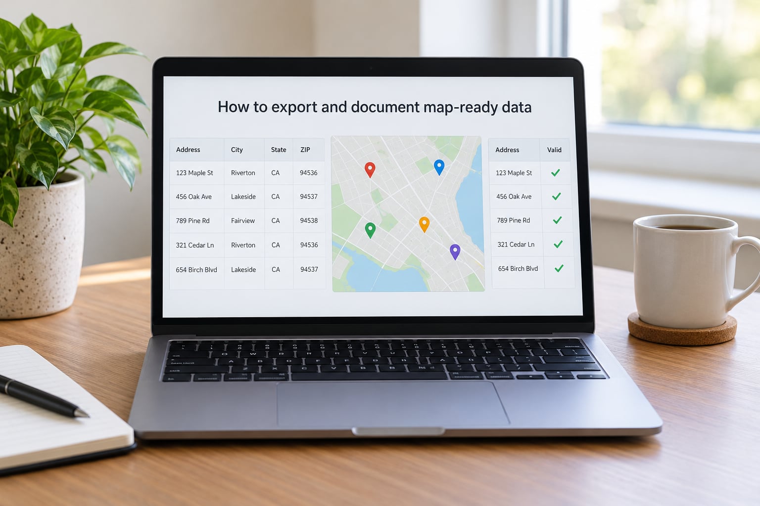
Round coordinates to five decimal places. The sixth decimal is sub-metre, which is finer than an interpolated street-level point can justify, and carrying it implies a precision your data does not have.
Before publishing, run a final QA pass: count the failed rows, report the match rate, and pull a random sample of 20 or 30 matched rows to open in a map viewer and eyeball. Publish those numbers rather than a success narrative, because a map that claims a 97 percent match rate without a failed-row count tells the reader nothing.
Check the cleaning script into the project repository with the rule table as configuration. If a colleague cannot reproduce your output from the raw file, you have an artifact, not a dataset.
Common Mistakes
Over-standardizing. Expanding every abbreviation and correcting spelling by assumption breaks legitimate variation, especially street names that genuinely differ by one letter. Standardize formatting; flag content.
Deleting rows you cannot resolve. A row that fails to geocode is a data problem worth keeping visible. Deleting it inflates your match rate and hides the failure from whoever has to explain it.
Trusting the automatic match. A confident-looking coordinate can still sit on the wrong block. Match type, score, and a human sample are the check; the API’s silence is not.
Overwriting the original. Once the raw string is gone, no rule can be re-run and no error can be traced. Keep it, always.
Cleaning after geocoding. You cannot fix a parse error that has already produced a plausible-looking point. The order is parse, normalize, validate, geocode.
Publishing interpolated points as exact locations. An interpolated coordinate is an estimate along a range, not a measured location. For sensitive events, school sites, clinics, or victims, publish at the level the data actually supports, and consider withholding coordinates entirely.
Geocoding the same place six ways. Every duplicate is another API call, another chance to disagree with itself, and another point on your map.
One cleaning pass for every country. US rules assume a state and a five-digit ZIP. Run non-US records through their own pass, and expect to leave transliterated local names intact rather than transliterate them yourself.
Frequently Asked Questions
What is the best way to clean addresses for mapping?
Parse, normalize, validate, geocode, in that order. Copy the raw table, add a stable row id, split each string into components such as house number, street name, suffix, unit, city, region, postal code, and country, then apply one canonical set of abbreviation rules to every row. Deduplicate on those normalized fields and keep the raw string beside them. Only then geocode, and store the match type and score with each coordinate so you can tell a rooftop match from a city centroid.
Should I standardize address abbreviations before geocoding?
Yes. Expansion of common abbreviations and removal of extraneous characters has a large effect on geocoding quality, because most geocoders match against a reference dataset that uses one spelling per street name. Normalize suffixes, directionals, and unit designators to a single form before you send a batch. The exception is text that is part of a proper name rather than an address component, where an expansion rule can corrupt a real building name.
How do I remove duplicate addresses without deleting valid locations?
Match on normalized fields, not on the raw string, and include the unit designator in the key so two apartments in one building stay separate. Keep a surviving row id and record every merged source id rather than deleting anything. Where exact matching fails, use Levenshtein or Damerau-Levenshtein distance only to propose candidates for review, since fuzzy matching merges Maple with Staple and misses Main versus Mane. When your data has no unit field at all, treat building-level merges as approximate.
What confidence score should I accept from a geocoding service?
The match type matters more than the score number. Accept rooftop and interpolated matches automatically, review street-segment results by hand, and treat city centroids and no-match returns as failures to send back to the cleaning step. Set the numeric threshold once, document it, and apply it to the whole batch. There is no community consensus figure for a good match rate, which is exactly why writing your own threshold and reporting it matters.
How should I handle apartment numbers and missing street addresses?
Parse the unit into its own field and include it in the deduplication key, otherwise two households in one building collapse into one point. Where a street address is missing, do not invent one. Rural and landmark records often resolve to a road segment or a locality centroid, so plot them at that granularity or exclude them and say so. For intersections, send two crossing streets to the geocoder as a relative address, and expect no match from some providers.
Can I clean addresses in Excel or Google Sheets?
For a few hundred records, yes. Trim whitespace, expand a fixed set of abbreviations with find and replace, split components into separate columns, and use a helper column to test for duplicates. Past a few thousand rows, or once you need a change log and reproducibility, move to OpenRefine, a Python script, or PostGIS. Spreadsheets are fine for exploring a problem and poor for recording what you changed.
Do international addresses need different cleaning rules?
Yes, and usually a separate pass. US rules assume a two-letter state and a five-digit ZIP that will not exist in most of the world, so applying them globally creates false confidence. Non-US records follow a different hierarchy of administrative areas, may have no house number at all, and may be written in a script or transliteration you should leave as received. OpenStreetMap data through Nominatim is usually a better reference than US-specific street files.
When should I clean addresses relative to mapping?
Before mapping, always. Cleaning happens on the address string, and a geocoder will happily return a plausible point for a string you never repaired, which is the worst outcome because the error becomes invisible. Clean, then geocode, then validate the match types, then publish. If you have already geocoded a batch, keep the raw strings and the returned match types, because you can often detect and repair the failures by re-running only the rows that failed.
Conclusion
Start with the boring part: preserve the source data and build a separate normalized table with component columns beside it. Everything after that, parsing, abbreviating, deduplicating, geocoding, and validating, becomes a rule you can re-run instead of a fix you have to remember.